Stuff I Know

Just stuff by me about me and my life, such as it is.

Thursday, January 17, 2008

At The Moment


View Larger Map

In case anyway was wondering, this is where I am today, January 17, 2008. I will be leaving tomorrow, though.

You'll notice my photo posts are a bit behind my actual location.

Labels: ,

Thursday, September 20, 2007

Biking at 11,000 Feet

More or less.

After riding a bike in Beijing, I figured riding couldn't get much more difficult anywhere else. Of course when I was figuring this, I never even considered altitude. Turns out, that wasn't much of a problem either.

Oh sure it affected me, but not in any way I wasn't already used to. Generally when riding, after a particularly long hill climb or a long fast stretch, I am breathing pretty heavily. Mouth open, deep, fast breaths if possible. I may breathe this way for a while until my body gets back into its natural rhythm.

However here in Lhasa, that kind of breathing started about 15 minutes and generally continued throughout unless I consciously tried to slow my breathing down. It wasn't really uncomfortable, just very noticeable. (Oddly, climbing stairs here makes me feel more out of breath than riding a bicycle here.)

I have gone on two rides here in Lhasa. Both of them had their difficulties, but I wouldn't count lack of oxygen among them.

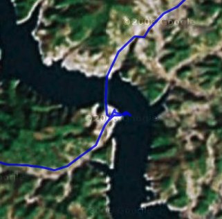
The first ride started well. I headed north out of the city to the Sera monastery at the base of the mountains surrounding the valley. I got there and the ticket taker said the monastery was closed that day. Some kind of monk event. Bummer! I thought since I rode all the way there I might as well take some pictures of the area. I wandered around and then noticed some other people go up to the ticket taker. There was a short conversation, money and tickets were exchanged, and in they went.

Hold on! I went back, asked if it was still closed, and the guy told me no, it was five yuan to go in. Five? The sign said fifty.
"Fifty?" I said.
"No, five"
Who was I to argue. In I went. It was an interesting place. Apparently the monk event was over.
After looking around the monastery I came out, sat down, and had lunch. Yes, peanut butter. And then it was back on the bike. I was headed to another monastery, Deprung, on the same side of the valley, but way on the other end of town. I could have gone back into the city and followed the main roads, but the map I had showed a road running along the base of the mountain. That would probably be more scenic.

After a few false starts I found the road. Unfortunately, the map didn't say that the road was unpaved. Oh well, what the heck, I have been on worse roads. It was the more scenic route, and more interesting allowing me to see more of life in Lhasa. And it was only unpaved in some places. Eventually the unpaved road met with the main road and it was on to Deprung monastery. The actual road up to the monastery was quite a hill climb at this altitude, but I made it.

This monastery was a bit more interesting than the other. It seemed more active, alive. But maybe that was just because there were more monks walking around. It was a nice place.

Click to see photos of the ride(Click the image to see photos of the trip.)


Now came the time for one of the best parts of riding a bike. Going downhill. Things were going great, I was enjoying the ride. There was a curve coming up, so I needed to slow down. I was going a little faster than expected, so the back tire started to skid a bit. The suddenly the bike skidded to a complete stop.

Let me explain something here. When a bicycle tire goes into a skid it is more susceptible to lateral, sideways, motion. This is partially due to it no longer spinning. This is generally not a problem ... on a good bicycle. However, because the person who put this bicycle together was obviously incompetent, the little skid this time was a big problem. That bit of sideways motion caused the rear tire to warp, bend, pretzel, whatever you want to call it, it twisted out of shape. If there had been more room in the frame, it probably would have turned into a mobius strip. Whoever had trued the rear wheel obviously didn't know what they were doing. The wheel had been straight, but some of the spokes were overly tight, while others were overly loose. This is what caused the wheel to bend. I had neglected to check for this before starting out.

The wheel was now so warped, it wouldn't even turn in the frame. And I was still up the hill near the monastery. If I had had the tools, I would have fixed it myself. But I didn't, so I couldn't. There was nothing to do but carry the bike down the hill. I picked up the bike so the rear wheel was off the ground and started walking, and walking, and walking.

Now maybe I am just too kind-hearted or something, but if I were in my car and saw someone obviously having difficulty carrying a bike down a road, even with a language barrier, I would at least have given them a ride to some place where they had a better chance of getting more help. At least five cars passed me as I was carrying the bike down the hill.

After about a kilometer or so, I finally got to the main road. Now I had to find a bike shop. Not an easy task in Lhasa, especially on the outskirts of the city. I looked left, right, and left again. I chose left. At least that direction headed back into town, which actually wasn't saying much. I picked up the rear of the bike and started walking. Luckily there was a motorcycle shop not too far down the road. Through mostly sign language, and Tibetan, which I didn't understand but got the gist of, he said it can't be fixed. Or more likely, he couldn't fix it.

By some rather odd coincidence, he had a 15 speed road bike at his shop. He was willing to sell me the rear wheel of the road bike, making that bike useless, for 100 yuan, about $13. This was actually a top quality road bike. Buying a wheel like that in a bike shop probably would have cost close to $100. Still, it was a road bike wheel, I was riding a Mt. bike; it was 15 speeds, the Mt. bike was 18 speeds. But what could I do? I had to get back to town.

I bought the wheel. He changed it. I took the original wheel with me (Heck if I was going to loose a $100 deposit. There had to be someone in town who could fix it.) and rode back into town.

To make a long story short, I found a scooter/bike shop ; the guy straightened and trued the wheel, fixed the flat, and put the original wheel back on the bike, all for 30 yuan. I just gave him the road bike wheel. What use did I have for it?


The second ride was also nice. I headed out of town just to try and see some of the countryside. I got pretty far, but then a storm was moving in in front of me so I decided I should turn around. On the way back I got a flat tire. Fortune or fate I don't know, but it saved me from being caught in the downpour. I walked back to the city I just passed, about 1 km, and had the flat fixed. By that time the rain had mostly stopped, so I continued in the new direction and then headed back to town.

Click the image below to see some photos from the ride. The photos are not bad, but I have to say the images don't do the actual view justice. You really have to be here it see it as it actually is. But have a look anyway.


Click to see photos of my second ride in Lhasa.


Labels: , , , ,

Friday, August 17, 2007

Yet More Maps

I thought I would try and get a few more things that I have been working on out before I finally lose my computer access.

Here is a Google Earth file of all the subways in South Korea. 

KMZ files require Google EarthSouth Korean Subways

The original work is not mine, but comes from the fine group of people at the Google Earth (Keyhole) forum. (Can't seem to find the actual post at the moment, sorry.)

It has all the lines in Seoul, Daejeon, Daegu, Busan, and Gwangju. It also includes platform locations and station exits for many stations. Of course the subway system is a work in progress, so there are a few mistakes and omissions, but nothing major. 

Now this might be useful on a GPS receiver also. Not for when you are actually on the subway, but for when you are above ground. If you are wandering the streets of any of these cities and want to find the nearest subway entrance, just pull out your trusty GPS unit and do a "Find" for POIs and viola. You are magically pointed to the nearest subway entrance.

I cleaned up the file some and converted it into something that will work on a Garmin GPS unit. It is transparent so it won't cover up your other loaded maps. I will give you the image so you can load it on your GPS, but take note. I had some problems making this work with MapSource. It would only work correctly if I sent it directly to the GPS unit. Also, you must use the provided type file to get the subway lines the right color. If you know how to use SendMap, then you'll have no problem adding this image to your GPS. Here is the zip file which includes the image and type file.

 Subways image and type files.

One more image file for you. This one I just did to teach myself how to do it and to see if everything worked OK. It is a contour map of the area around Andong-shi. It has major and minor contours at 20 meter intervals. The data comes form the Shuttle Radar Topography Mission program which mapped most of the Earth's elevations. The data for Korea was only available at 90 meter resolution, which is not the best, but it was all that I had to use at the time. It is also a transparent map. If you want to see those mountains ahead of you on the map, download this file and use SendMap to load it onto your GPS unit.

Andong-shi contours image file. This is a large file (+10 Megs) so I've put it on a file hosting site. If it disappears, let me know and maybe I can send it to you.

Labels: , , , ,

Tuesday, August 14, 2007

More Maps

Since I was talking about Google Earth a bit ago, let me continue. Google Earth is a great program. It lets you see the world from a whole different perspective. You should try it out. There are versions in several languages, even Korean,

Unfortunately, the images are only as good as the data and, for South Korea, the data is certainly lacking. Look at this ...

The left is Las Vegas, the right is Andong

On the left is the image data for where I grew up, Las Vegas, USA. On the right is the image data for where I live now, Andong, South Korea. Now not all of Korea looks like Andong. The major cities have some very nice high resolution imagery. Unfortunately most of South Korea is pretty low resolution (a lot of North Korea is pretty hi-res, though).

And it is not just image data; road data suffers also. Most western countries have excellent road data which displays in Google Earth and Maps. Even some eastern countries have good data. In fact, South Korea is one of the few industrialized nations which doesn't have good road data. Heck, even India has good road data. Sure you can see some roads in Korea, but what is displayed (as of this post) is rather laughable. Only the major highways are shown and then even not all of those. And the positions for those roads are only good if you are viewing form about 250 km up in the sky (Actually, now, no road data is being displayed for Korea.).

Part of the reason for the great road data in the USA and Canada is the fact that information about the roads is gathered by the government using public funds, so the data becomes  public property. In India they have the legacy of British colonization from which they inherited a system of data organization. Also Google is working with the local population in India to help update road data in some cities.

I figure I can help Google in the same way. Use my local knowledge of the place to provide far better maps of Korea than what is available at the moment. Well, at least my small portion of Korea. So here it is. I give you Andong, with roads (and rivers and lakes and more).

 I've even got data for when you zoom in close.

 In addition to the road data, some lakes, rivers, trails, and interesting locations are there for you to see. This was all done mostly through capturing location data with my GPS receiver as I rode around the city on my bicycle. Other information was entered from scanned maps and such. I am offering it here for anyone to use. Take the data, use it, modify it, do whatever you want with it. Just make sure you read the Creative Commons copyright information I have for this site and follow the restrictions. Here is the Google earth file for you to download.

KMZ files require Google Earth

 Andong-Area

A few notes about the data ... the rivers, lakes, and streams were all taken from scanned map data, so possibly the outlines and waterways may not match up exactly with the images from Google Earth since the image data is from a different time period. Every road or trail shown is passable on a bicycle and most of them are drivable. However, paths listed as trails would likely be bike or walking only. Unpaved roads may be just that or they may be paved; even so you should probably treat them as trails because they are usually single lane farm roads in poor condition. Pedestrian roads, one way roads, restricted roads or intersections and similar are not listed as such. This is just path data. As always, I just provide you with the data. What you do with it is your business. I can not be held responsible if you get into trouble using the data from this site.

Now you may be saying to yourself... "Wow, this is a great resource. Now if I could only put this on my Garmin GPS receiver it would be really useful." Well you can because that is the really the whole reason I collected the data in the first place.

Here is the source file, Andong-Area-with_points.MP, for GPSMapedit. Take it, correct it, add to it.

If you would rather just have the image file to use with SendMap, here you go. Andong-Area-with_points.img

You should right-click those files and choose "Save as ..." to download. The data is probably in its final for. I doubt I will be making any additions to it. You can always find it here, or have a look at Mapcenter were you can find lots of map data. In fact, you might want to use the Mapcenter.com img instead of the one here. The one at Mapcenter has POI (points of interest) indexing.

Labels: , , , , , ,

Thursday, August 09, 2007

Mileage

No, I haven't posted in a while, but I haven't been all that lazy.

One thing I have been doing is riding my bike. With the consecutive streak ending about two weeks ago, for ten weeks I went on ten rides. The total distance (Is there a equivalent metric word for 'mileage'?) for those ten rides was 1024 km.

That's about about three times the distance from Seoul to Pusan and close to four times the distance from east coast to west coast. Unfortunately I was not traveling in a straight line. Most of the rides were loops out of and back into Andong. Much of the area I have covered before, but I did see some new interesting scenery.

Here is an image which shows the different routes I took.

KMZ files require Google Earth If you want to explore the routes more closely, you can download the KMZ file and peruse in in Google Earth. (If aren't using Google Earth yet, you really should be.)

If you want to see a Google Maps version, go to this page. Note that the routes are less precise than the Google Earth version and the map may slow your computer down if you have an old computer. Also, only a small area west of Andong has high resolution imagery. Have a look, though.

If you want to follow in my footsteps, the route labeled "06/30/07" runs through some pretty nice scenery. Canyons, rivers, valleys, mountains, the whole gamut. It is really nice after a rain shower when the air has been cleaned of all the haze. The green can certainly be amazing here.

Labels: , , , , ,

Thursday, May 04, 2006

The Big Picture

OK, here is another update on all the bicycle rides I take here around Andong. If you haven't seen the earlier postings, what I do is strap my Garmin eTrek unit to the handlebars of my bike (I have kind of MacGyver-ed my own mount) and go for a spin around the countryside, all the while recording my position via GPS satellite. When I get home, I download the data to my computer and display the maps in any number of various ways. All good fun!


I have displayed all the recorded rides this time, so things are looking pretty colorful. As you can see (click for a bigger image) I have covered a lot of territory. I don't have a total distance for all these rides handy, but the last one I took, that southern yellow east-west line, was just over 88 km. all the way around. Maybe some day I'll post some statistics on the rides.

If you want to have a closer look at some of the rides, I have a Google map for you of the last five I took. Click this link and a Google Map will open in a new window. Once there, you can scroll around by clicking and dragging the map, zoom in or out with the scale on the side, and turn individual rides on or off by clicking on the colored name.

Something interesting ... Find the spot on the dark blue trail, 23-April, where I cross the lake/river - straight to the north. Center the map on that spot by double-clicking there. Then click on the zoom scale between the 5th and 6th mark from the top. (Note: if the trail doesn't redraw after the zoom, you can make it redraw by clicking the trail name off then back on. It might be slow.) With the trail off, you can see the bridge. With the trail on, you can see where it looks like I went past the bridge and down into the lake.


I assure you I didn't ride my bike into the lake. I am not sure when these images were taken, but the lake is not as wide as it looks in the picture. There is a boat ramp there, and actually the lake is about half the width you can see in the picture. I don't think the lake has been up to these levels in quite a while.

If you want to see the rides in 3-D you can download the Google Earth KMZ file. Just click on this link and the file will load and start up Google Earth. Zoom, pan, tilt, and view to your heart's content.

Labels: , , , ,

Tuesday, March 21, 2006

All Roads Lead to Andong

This is just an update on the map of all my rides, and a couple of walks, around Andong. If you were to compare this map to the other two I have posted here (1,2) then you'd notice that the scale is a bit different. That is because this time I had to zoom out to get the entire ride to the southern city on the map.


All the previous rides are black and the newest five are colored. This is all the rides up to, but not including, the ride I took on March 19th. If you click the image to see it bigger, you can see that I have just been filling in the spaces a bit. Except for the southern ride, that is. That ride was to the nearest "big" city to the south. I have already ridden to the northern and western cities. The only one left is to the east.

If you want to take a closer look, you can download the KMZ file for Google Earth. That way you can zoom in and out and mover around to your heart's content.
Somerides-3.kmz

If you don't have Google Earth, you can view the recent rides on a Google Maps link where you can still move around and zoom in and out. Note: If your computer is slow, this Google map might take a while to draw and might slow down your computer even more.
My rides on Google maps.
Oodles of thanks and accolades to the site GPSVisualizer.com for the service that makes creating this map possible, and so easy.


"When all's said and done, all roads lead to the same end. So it's not so much which road you take, as how you take it."
~ Charles de Lint

"People take different roads seeking fulfillment and happiness. Just because they're not on your road doesn't mean they've gotten lost."
~ H. Jackson Brown, Jr.

"All of life is a journey. Which paths we take, what we look back on, and what we look forward to is up to us. We determine our destination, what kind of road we will take to get there, and how happy we are when we get there."
~ Unknown

Labels: , , , ,