Yet More Maps
I thought I would try and get a few more things that I have been working on out before I finally lose my computer access.
Here is a Google Earth file of all the subways in South Korea.
The original work is not mine, but comes from the fine group of people at the Google Earth (Keyhole) forum. (Can't seem to find the actual post at the moment, sorry.)

It has all the lines in Seoul, Daejeon, Daegu, Busan, and Gwangju. It also includes platform locations and station exits for many stations. Of course the subway system is a work in progress, so there are a few mistakes and omissions, but nothing major.
 Now this might be useful on a GPS receiver also. Not for when you are actually on the subway, but for when you are above ground. If you are wandering the streets of any of these cities and want to find the nearest subway entrance, just pull out your trusty GPS unit and do a "Find" for POIs and viola. You are magically pointed to the nearest subway entrance.
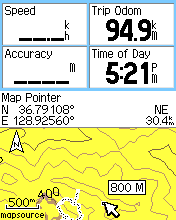
I cleaned up the file some and converted it into something that will work on a Garmin GPS unit. It is transparent so it won't cover up your other loaded maps. I will give you the image so you can load it on your GPS, but take note. I had some problems making this work with MapSource. It would only work correctly if I sent it directly to the GPS unit. Also, you must use the provided type file to get the subway lines the right color. If you know how to use SendMap, then you'll have no problem adding this image to your GPS. Here is the zip file which includes the image and type file.
One more image file for you. This one I just did to teach myself how to do it and to see if everything worked OK. It is a contour map of the area around Andong-shi. It has major and minor contours at 20 meter intervals. The data comes form the Shuttle Radar Topography Mission program which mapped most of the Earth's elevations. The data for Korea was only available at 90 meter resolution, which is not the best, but it was all that I had to use at the time. It is also a transparent map. If you want to see those mountains ahead of you on the map, download this file and use SendMap to load it onto your GPS unit.
Andong-shi contours image file. This is a large file (+10 Megs) so I've put it on a file hosting site. If it disappears, let me know and maybe I can send it to you.
Labels: Garmin, Google Earth, GPS, Korea, maps
posted by Alimamo @ 5:38 PM
![]()
![]()


2 Comments:
I see your pretty into maps, and GPS. (Looks like you have even created them). Question, I have a Garmin Nuvi 350 I use in the US. Have you seen a way to get these to work with MapCenter Maps, like the one you made for Korea? How do you do that exactly? Thanks for any help, cool blog.
Sorry JayBougie, I don't know much about the Nuvi. There are several map-making groups you could ask at though. I think you can put MapCenter maps on the Nuvi, but you should ask others. Search the Yahoo (and Google) groups for "Garmin", "Mapcenter", "Nuvi" and "map authors". Sorry I couldn't be more help.
Post a Comment
<< Home